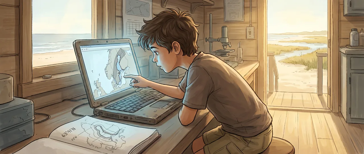
The Place the Model Doesn't Know
The AI did not look like anything. It was just a program on the field station's old laptop, but Soren liked it because it answered honestly. When it did not know something, it said so, and it said so with numbers.
His mother had gotten him guest access to the Earth Observation Collaborative's coastal prediction tool as a birthday present, which was exactly the kind of present she would give. She was three rooms away running her own models on deep Atlantic circulation, and when Soren had shown her the interface that morning she had said, "Oh, that's the Hendricks group's work. Very solid. Have fun," and gone back to her screens.
So Soren was having fun.
The tool let you pick any coastline on Earth and ask: how much will the sea level change here in the next fifty years? It pulled from tide gauge records going back to the eighteen hundreds, satellite altimetry since nineteen ninety-three, ocean temperature profiles, gravitational data from the GRACE satellites, all of it fed through a model that learned regional patterns no global average could capture.
Soren had started with places he knew. Galveston, where he was sitting right now. The tool gave him a prediction: fourteen to twenty-three centimeters of rise by twenty seventy-five. It also gave him a confidence band, a gray shaded zone around the prediction line, and the band was narrow. The model was pretty sure.
He tried New York City. Twelve to nineteen centimeters. Narrow band. Sure.
He tried Mumbai. Wider band, but not by much.
He tried every coastline he could think of, writing down the confidence ranges in his notebook, because the numbers felt important in a way he could not yet name. Tokyo. Sydney. Lagos. The model had opinions about all of them, and its opinions were tight, certain, backed by decades of data.
Then he tried the Gulf of Bothnia.
He had picked it because he had been reading about Scandinavia. The Gulf of Bothnia is the northern arm of the Baltic Sea, between Sweden and Finland. The model gave him a prediction and the gray band exploded. It went wide, then wider, then at certain points along the coast it became so broad that the model was essentially saying: the sea could rise here, or it could fall, and I genuinely cannot tell you which.
Soren sat up straighter.
He clicked on three different points along the Finnish coast. Same thing. Enormous uncertainty. He clicked on Stockholm, just south. The band tightened. He clicked on a point fifty kilometers north. It blew wide open again.
He opened his notebook and drew the coastline from memory, marking each point with its confidence range. The uncertain zone had a shape. It was not random. It followed the coast where the last ice sheet had been thickest, ten thousand years ago.
Soren knew about post-glacial rebound. His mother had explained it once during a long car ride. The ice age glaciers had been so heavy that they pressed the Earth's crust down, like a thumb into bread dough. When the ice melted, the land started rising back up. It was still rising. In parts of Scandinavia the land was climbing out of the sea by nearly a centimeter a year.
So the model had two forces to predict at once. The sea was rising from warming. The land was also rising from an ice sheet that melted thousands of years ago. And the model could not figure out which one would win.
He typed into the query box: Why is uncertainty highest in the Gulf of Bothnia?
The tool answered the way it always did, with numbers and sources. It listed three factors. Post-glacial rebound rates that varied across short distances depending on the thickness and duration of the ancient ice load. Changes in the Earth's gravitational field as ice mass redistributed. And something Soren had not expected: the mantle viscosity beneath Scandinavia was not uniform, so the rate at which the land bounced back depended on how thick and how fluid the rock was forty kilometers underground.
The model could not see underground. It could measure the land rising from the surface. It could measure the sea rising from space. But the thing that determined how those two forces would race each other over the next fifty years was the consistency of rock deep in the Earth's mantle, and that was something no satellite and no tide gauge could tell it.
Soren read the line three times. Then he read it again.
The AI had centuries of tide data. It had satellites measuring ocean height to the millimeter. It had temperature records for every layer of the ocean. And the thing it could not predict came from below. From rock that had been squeezed by ice before any human kept any record of anything.
He walked three rooms down to his mother's office. She was eating a granola bar and staring at a plot of thermohaline circulation.
"Mom. The Hendricks model can't predict the Gulf of Bothnia."
"Hmm?" She turned fully. "What do you mean it can't predict it?"
"The confidence band is huge. Like, the model doesn't know if sea level will go up or down. And I think it's because of the mantle."
She put the granola bar down. "The mantle viscosity problem. You found that?"
"The model told me. I just asked it why it wasn't sure."
His mother looked at him with an expression he did not entirely recognize. It was not surprise, exactly. It was something closer to recalculation.
"Soren, that's one of the open questions in the field. Not the model's uncertainty. We know about that. The question is how to reduce it. We can constrain rebound rates with GPS stations on bedrock, but the viscosity structure underneath, that's. Well. That's what people are working on."
"So the model knows what it doesn't know," Soren said.
"Yes. That's actually the most important thing a model can do."
She turned back to her own screen, then turned back. "Did you write down the coordinates where the uncertainty spikes?"
"I drew a map."
"Can I see it later?"
"Yeah."
He walked back to the laptop. The Gulf of Bothnia was still on the screen, its gray uncertainty bands wide and honest. Somewhere under that gray was a question about rock that had been pressed for a hundred thousand years and was still, right now, slowly, invisibly, remembering.
Soren scrolled the map south along the coast, watching the bands narrow as the ancient ice thinned. Then he scrolled north again and watched them widen. He found the exact latitude where the model tipped from sure to unsure. He marked it in his notebook: sixty-three degrees, forty-one minutes north.
Then he typed a new query. He asked the model to show him every other place on Earth where its uncertainty was highest.
The map lit up. A handful of points, scattered across coastlines. Hudson Bay. Patagonia. West Antarctica.
Every single one was a place where ice had pressed down on the Earth and then let go.
Soren pulled the laptop closer and began clicking on them, one by one, writing down the coordinates of every coastline on Earth where the future depended on how fast the planet could remember its own shape.
Read the interactive version, listen to the narration, and earn a gold star →
A science-verified short story for curious kids · Curiosity Land